
Lake Faucharie

Lake Faucharie outlet - Canyon Creek
From Truckee, take Hwy 89 North towards Sierraville, Ca. an 8.6 miles before you get to Sierraville, turn left on Dog Valley Road. I have also seen this called Henness Pass Road., regardless, there is a sign on Hwy 89 that points you left to Jackson Meadows Reservoir. Continue on this road for 16.3 miles. At this point, you will be at Jackson Meadows Reservoir, and there will be a dirt parking lot on the right with a bathroom. This is one starting point of this ride. If you want to make the ride shorter, you could drive over Meadow Lake Road to Jackson Creek Campground and start there. It all depends on how much gravel riding you want to do. For this write up, I am going to start at the parking area for Jackson Meadows Reservoir.

The rocky road from Jackson Creek Campground to Lake Lake Faucharie.
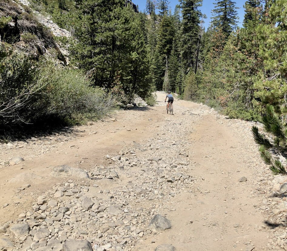
From this parking area, mount up and ride the pavement West across the Dam. Looking over the dam on the right side, you will see the pressure vent blowing water into the spillway below. Makes for a cool picture. Continue on the paved road, and it will cross the dam and wind South. It stays pavement for about 2.5 miles, then turns to dirt. Continue uphill for about 1 mile on what is now Meadow Lake Road to the summit. At the summit, drop strait west down hill for 2.7 miles, and you will be at Jackson Creek Campground. If you continue strait West, you will Hit Bowman Reservoir. If you go left, you will head up to Lake Lake Faucharie, and Sawmill Lake. From this intersection, it is 3.4 miles all uphill to Lake Faucharie, and you wil pass Sawmill Lake at 1.4 miles. You can’t see Sawmill Lake from the road, but it is just off the road. I was short on time, so we did not stop to look at this lake, but I will update this post to include Sawmill Lake this year (2022). From Jackson Creek Campground, the road gets a little rocky. A 29’er mountain bike would be ideal, but completely ridable on a gravel bike if you just take your time and chose your line. Once you get 2.75 miles towards Lake Faucharie from the campground, you will cross over Canyon Creek, which is the creek leaving Lake Faucharie. The water is just amazingly beautiful. Continue up the road for just under a mile, and you will be at Lake Faucharie. Take some time, it is a stunning lake, surrounded by granite, and a beautiful sapphire blue. When you have taken it all in, retrace your steps back to the car for 19.2 mile ride with 2285 ft of vertical gain.


WHEN ACCESSING THE RIDE WITH GPS LINK BELOW, THERE IS A DROP DOWN MENU ON THE UPPER RIGHT OF THE MAP. THIS DROP DOWN MENU ALLOWS YOU TO CHANGE THE KIND OF MAP YOU ARE LOOKING AT, FROM A GOOGLE SATELLITE MAP TO A USGS TOPO MAP, AND ANY OTHER MAP IN BETWEEN. IF YOU WOULD LIKE THE GPS FILE FOR YOUR GARMIN, FEEL FREE TO E-MAIL OR CALL THE SHOP.