
Smoke from the Caldor Fire of 2021. Looking South.

Looking back at what you climb up.

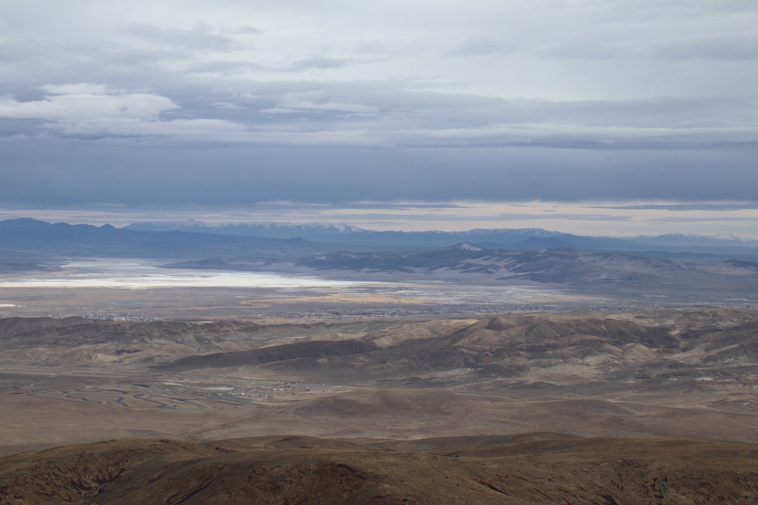
Smoke from the Dixie Fire of 2021 looking North.
A couple years ago I did this climb and hated it. The road was horribly rocky, loose and steep. Recently, someone put in a new radio tower past where the old road used to stop. The road to this last tower is gated and posted “No Trespassing,” but they graded the road from the bottom, all the way to the new tower. This is now a smooth climb all the way to the final gate with stunning 360 deg views. On a clear day, you can see Pyramid Lake to the North, and forever to the South, East and the Sierra to the West. If you like to climb, and you like open desert views, this is your ride. This ride is best done in spring or fall, or even winter if there is no snow. It gets super sandy at the base during the summer, and gets super hot. I rode this ride in the late summer of 2021. We had 2 huge California Wildfires raging at the same time. One to our North, the Dixie Fire, and one to the South, the Caldor Fire. The day I rode this ride, winds were due east, and Reno sat right between the plumes of smoke with just a clearing to bag the ride. You can see the smoke in the pictures below.
From Reno, Take I-80 East to American Parkway. Take a right and follow American Parkway South to the Round About at Hwy 50. Follow the round about to head East towards Silver Springs. In 1/2 mile, turn left on Ruby Avenue, and this is your start. Park here, and start riding. Head North on Ruby Ave, and you will encounter a couple sandy short sections but no big deal. In 2.6 miles from the car, you will be past all the houses, and entering the canyon. In the middle of the summer, this canyon can get super hot with little air flow through it. This is why it is best to do the ride early or late, but not in the middle of the day during the summer. Continue up the canyon, and you will pass an old abandoned mine site and continue climbing. In 4.8 miles from the car you will hit an intersection. Stay left. The right road drops down a steep, loose, and rocky road and drops you out on Alt 95 to Fernley. So, stay left and you will move out of the canyon into open space. There are a couple side roads on your way up to the towers, but the main graded road is clear. Continue climbing West, and in 8 miles from the car you will be at your first collection of Radio Towers. If you are a rock hound, there is a ton of agate in the hillside all around these towers. At this point, you can decide that you have had enough climbing, take a look around, and head back. If you still want more, continue past the towers heading west. There will be a short downhill, then back to climbing to the second set of towers. At 9.6 miles from the car, you will be at the second set of towers. Just past these towers, you will run into the “No Trespassing” sign, and you can see the road drop downhill, then back up to the last tower. Honoring the “No Trespassing” sign, prop your bike up against one of the Juniper Trees and hike around and take in the stunning 360 deg views. When you are done, retrace your steps back to the car.


WHEN ACCESSING THE RIDE WITH GPS LINK BELOW, THERE IS A DROP DOWN MENU ON THE UPPER RIGHT OF THE MAP. THIS DROP DOWN MENU ALLOWS YOU TO CHANGE THE KIND OF MAP YOU ARE LOOKING AT, FROM A GOOGLE SATELLITE MAP TO A USGS TOPO MAP, AND ANY OTHER MAP IN BETWEEN. IF YOU WOULD LIKE THE GPS FILE FOR YOUR GARMIN, FEEL FREE TO E-MAIL OR CALL THE SHOP.