Clear Creek Trail - Carson City, Nevada - 29 mile round trip - 2638 feet of climbing.
Intermediate to Strong Intermediate
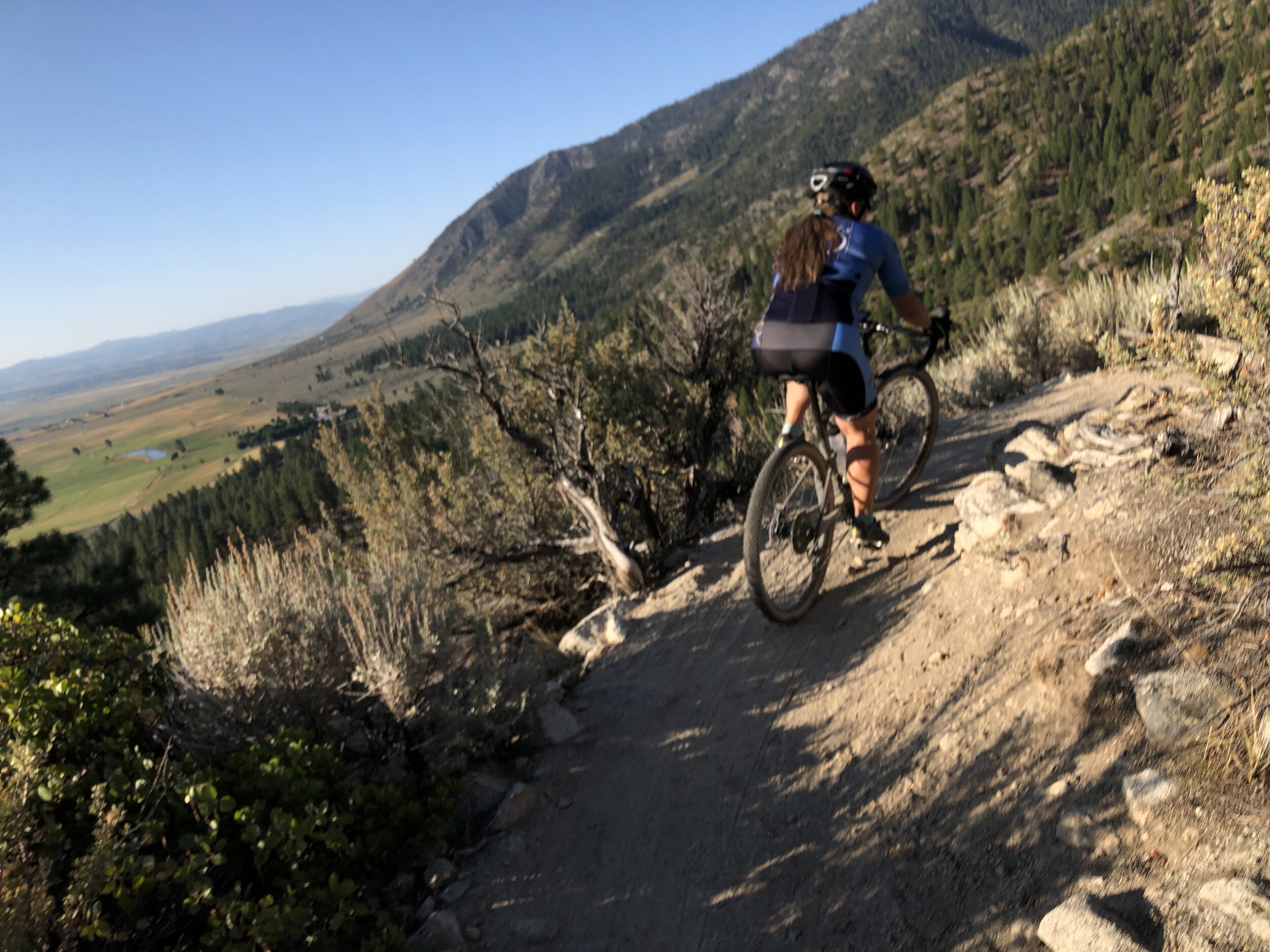
Clear Creek Singletrack with Carson Valley below.

The view of Carson Valley from above.
This trail is not all that difficult in the way of technical ability. The entire trail is fairly sandy, and easier to ride in the spring and fall when all the sand is held in place by the wetter conditions. 2/3rds of the way up, there are some technical rocky step ups rocky ride over’s, and a handful of sandy and steep switchbacks, but all of these features can simply be walked over if necessary. Jump off your bike, take 10 - 12 steps, then right back on your bike. The most difficult part of this ride is the 14.5 miles of uphill. There are a handful of small down hill sections to this climb, but mostly uphill. My GPS showed 27.76 total miles, but because this trail serpentines all over the place, many times the GPS will just strait line the route, missing the turns. That probably accounts for the difference. There is a trail marker at the start that says the climb is 14.5 miles to Spooner Summit.

Aspen Forest near Spooner Summit.
Directions:
From Reno, take I-580 (hwy 395) south all the way past Carson City. I-580 will drop you off at the bottom of Spooner Summit at a light. Take a left on Hwy 395 and head up the hill. Right near the top of the hill, at a light, take a right on Jacks Valley Road for just under 2 miles. At almost the top of the hill, you will see a pull out on your left side. Park here, and you will see the Trail Head Sign. If you start driving downhill, you went too far. From the parking area, it is almost impossible to get lost. The trail starts out rather sandy, so if you are riding this trail in the summer, leave early. This would be a hot and miserable climb in the afternoon heat. The trail does cross a couple old roads, but it is very well marked as to where the trail is. At 2.5 miles, you will cross a dirt road. Continue directly across this road. There is a sign, but when the singletrack drops you out on the road, the direction tends to send you up the road, not across it. So you have to almost turn left to cross the road to get back on the singletrack. There is a sign, but the first time, you have to look for it. You cross a couple other roads, but they are very simple, and you can see the trail on the other side. At 4 miles, you will encounter your first switchbacks. Just take them wide and slow. Once you get 7 miles up the trail, you will encounter the most technical section of this trail. There are a whole series of tight and sandy switchbacks with a couple rocky sections. Again, nothing you could not just jump off your bike, take 10 - 12 steps, then right on your bike again. You will clear this section at mile 10 of the climb. From mile 10 to Spooner Summit, it is a delightful ride. There are a couple slight rollers, through a beautiful aspen forest, Sugarcone Pinecones litter the ground, and the trail is smooth all the way to Spooner Summit. Do be aware that many riders love to shuttle this ride. The leave a car at the bottom, and drive up to be dropped off at Spooner Summit, then ride down. Just be aware of downhill traffic. Once at Spooner Summit, you really have 2 options. If pressed for time, you can always just ride down Spooner Summit (Hwy - 50) to Hwy 395, and take the pavement back to the car. This option will be at least 30 minutes faster than taking the singletrack back down. Or, just retrace your trip back down to the bottom. It is a great downhill.

Bridge Crossing Clear Creek.
We rode this ride on our Cannondale Topstone Lefty Gravel Bikes, and it was fantastic. Because of all the sand, a 29’er mountain bike would probably be faster, especially downhill, but the gravel bikes did fantastic.
Here is the GPS Strava route for Clear Creek
Here is the GPS Garmin route for Clear Creek

Map and elevation profile for Clear Creek, Carson City, Nevada.