
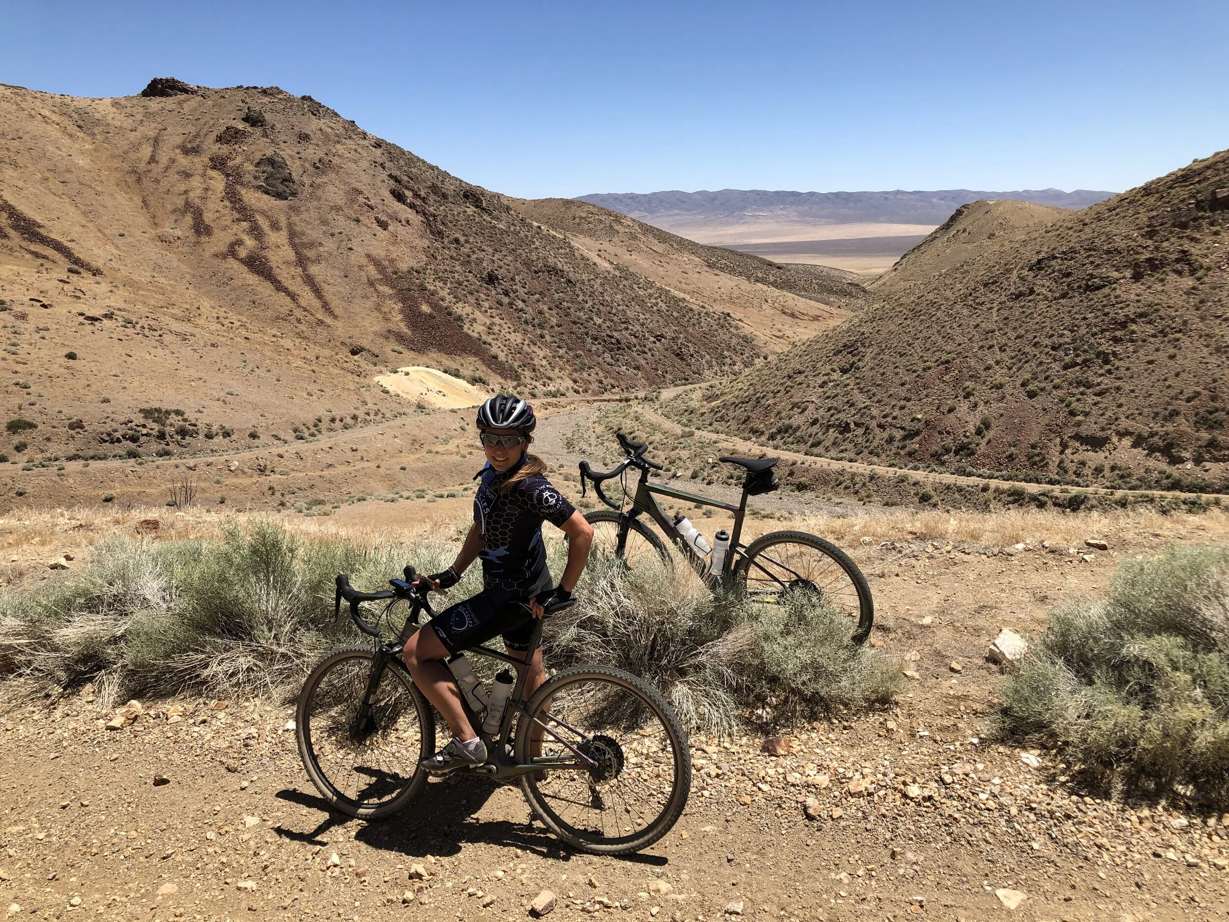

Near the top of Seven Troughs Canyon. Mazuma was located at the bottom of this canyon. We are on 2020 Cannondale Topston Carbon Lefty Gravel Bikes.

The Seven Troughs Mountain Range is directly West of Lovelock, Nevada, or about a 1:30 drive East from Reno. This mountain range is full of natural springs, and one of them has seven troughs that are fed by one spring (named for troughs built in 1894 by Frank M. Ward to water his sheep), and was also full of gold ore which was discovered by Joe Therien, a Lovelock blacksmith, in 1905. In 1907 Mazuma was born in the mouth of Seven Troughs Canyon. The gold was found all the way up the canyon with the best ore near the top. Today, the road goes 3/4 of the way up the mountains and dead ends at a spring. This spring water was piped down into the town of Mazuma, and most houses had fresh running water. This running water was the driving force for Mazuma as most gold mines in the state struggled for water.

The Darby 10 Stamp Mill, or what’s left of it.
As the mining continued following the gold ore deposit further and further inside the mountain, the town grew. It had a constant population of over 350 people, over 5,000 miners, a Post Office, Hotel, Fire Department, Livery Stable, General Store, multiple Saloons, School and many homes. This was the center hub of the Seven Troughs Mining District. Up the canyon two different stamp mills were erected, as well as a ball mill. Both would pulverize the gold ore into smaller and smaller bits.
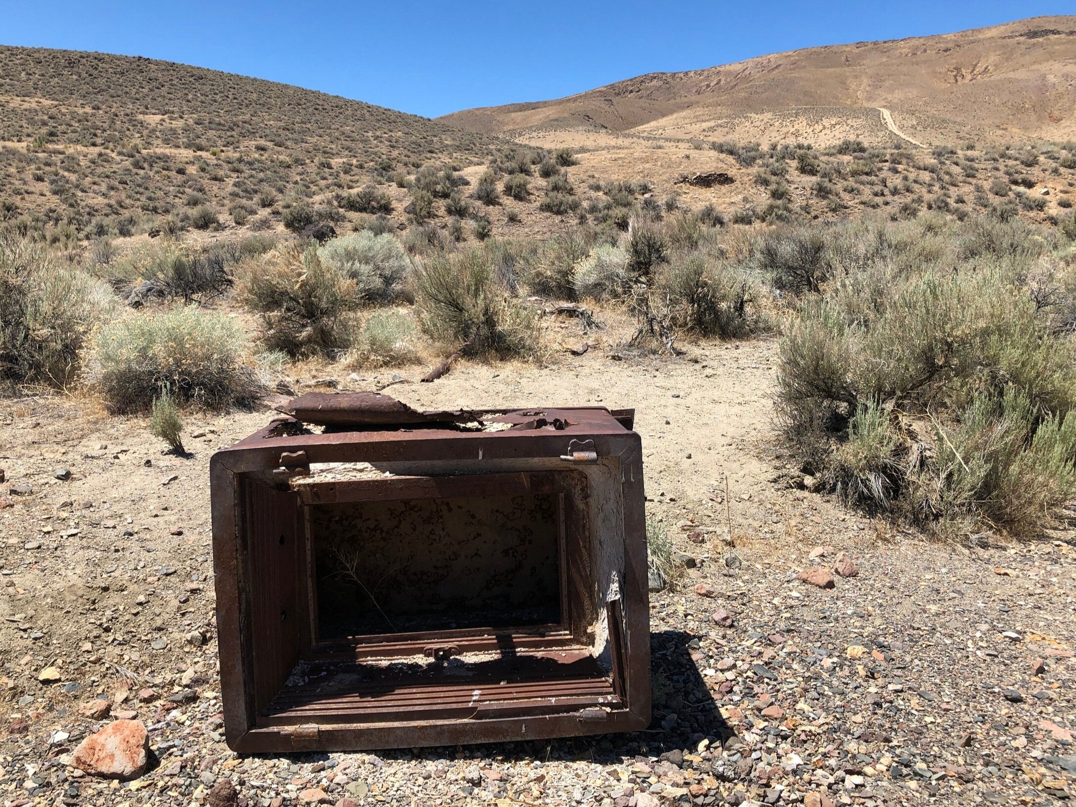
Old safe from the Mazuma town site.
There was an upper Cyanide Plant / pond that was used to recover the gold and silver ore. The Cyanide would bond to the gold and silver in the smashed ore and using a Zinc powder would be extracted. Mazuma produced some of the most pure gold ever extracted in the State of Nevada. Once retrieved, they would separate the gold from the Cyanide and reuse it. As the activity grew, a lower leach pond was established and activity was rampant with a third stamp mill erected just outside the town of Mazuma.

Old Mine Shaft.
As they dug down following the gold, they hit a very high water table that flooded the shafts preventing any further deep mining of the gold. Thus, Tunnel Camp was born. Tunnel Camp was located about 1 mile South of Mazuma. The idea was to drill / dig a tunnel through the mountain to drain the water out of the mines in Seven Troughs Canyon. Once the tunnel reached the other side, they were 700 feet too high, and not able to drain any water from the mines. The mining continued for a couple years above the water table.

Coalition Cyanide Plant.
In the afternoon of July 12, 1912, there was a huge thunderstorm that hit the top of the mountain. The rains dumped and water started filling the upper Cyanide pond. The dam collapsed sending a torrent of caustic water down the canyon into the lower Cyanide pond. This dam also failed and a wall of water 20 feet high came crashing down the canyon into the town of Mazuma washing most of it out into the playa below.
Reports say water rushed through the town for a solid 10 minutes. Nine people (3 of which were children) perished in the flood, and 3 others succumbed to their wounds. Then a couple of days later, the large 10 stamp mill at the top of the canyon, the Darby Mill caught fire. The flood had destroyed the water system, so the mill burned to the ground. This ended the activity in the Seven Troughs Mining District.

Looking back across the valley at the road we traveled on.
The ride starts off Highway 399 (Here). This is a Google Link that will take you to the start. You can even put in your start address and send the driving directions to your phone. Here is the Strava Link.
The ride starts at the intersection of Hwy 399 and Seven Troughs Road. It is a gradual up and down, mostly down to the first intersection. However, you might just want to drive down to the first intersection because this canyon can be very hot on the return trip. Because it is in a canyon, there is little air flow, and we hit 108 deg on our return trip. Made the last climb miserable. If you are riding this in the spring or fall, no big deal, but in the summer, you will cook on the last climb heading back to the car.
No matter which way you decide to do the ride, make sure you take your first left, 4.7 miles. It is a huge smooth gravel road. If you go right, it just goes on and on across the playa. You can take your next left to end up in the same place, but better to just take your first left. Continue for 3.5 miles and you will see that little connector road come in on your right. Now it is a strait shot out to Tunnel Camp, or Mazuma. Continue for 2 miles. At this intersection, you have a choice. You can see the buildings of Tunnel Camp up on the hillside to the left. If you continue strait, you will head up Seven Troughs Canyon through Mazuma. For this ride, continue strait for another 3 miles. You will see a road to your left, and this is the connector for Tunnel Camp if you want to hit it on your way back. Continue up the canyon, and you will almost immediately see debris everywhere. Remember that Mazuma was washed away, and this debris comes from that washout. You will see some foundations, a large safe, and in just over 2 miles you will come to your last intersection. This is a loop, you can take the left or right. We went left, and you immediately hit the ruins of the Darby Mill. Just above that you will see an old water tank, and loop around to some old mines and wooden structures. You could spend some time in the area if you brought along hiking shoes. There is stuff everywhere.
From here, you are going to retrace your path back down. All little side roads end up in the same place. They jet around little washes as the canyon will hold water at different times of the year, so jeeps have created little work arounds, but they all end up at the same place. Once you are at the Mazuma town site, you can take the road to your right for 1.2 miles and head over to Tunnel Camp. This road is nice and smooth, and follows the contour to Tunnel Camp. You can read all about Tunnel Camp in the previous link. It is a great site to visit. Just below Tunnel Camp is the cemetery for those that perished in the Mazuma flood. It is interesting to walk around this cemetery. There are no head stones, just wooden crosses, that like Mazuma and Tunnel Camp, have been fading away with time exposed to the elements.
From this point, retrace your steps back to the vehicle. Be careful if riding in the summer, the last climb can be very hot.

Mazuma cemetery with Tunnel Camp in the background.

The route we took. We took a wrong turn making an “A”. Take the first left to avoid the out and back.
