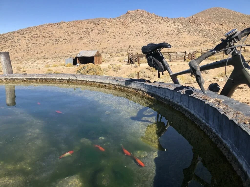
Lower Stonehouse Spring and Cabin

This is what most of the ride looks like. An amazing road!
I have always been fascinated with the desert. It’s beautiful landscapes, views, rocks, and just everything about it. It has always amazed me that Native Americans were able to carve out a living in this environment that has been fairly static (but drying) for the last 10,000 years. So when I have free time, I love to explore via Google Maps and see what is out there. Here and there I find old abandoned cabins that are literally in the middle of nowhere. Then I wonder why someone would have chosen that spot to try and carve out a living.
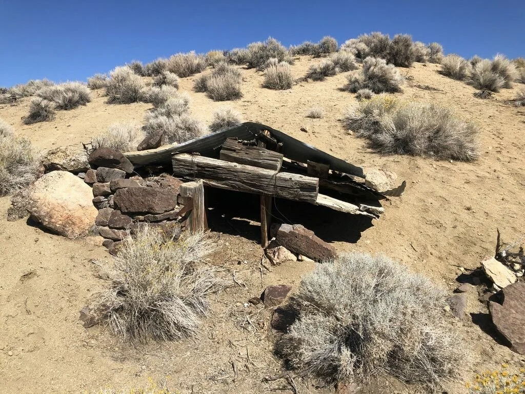
While browsing Google Maps, I found an old Cabin in the Shawave Mountains. This mountain range is the second mountain range East of Hwy 447 to Gerlach, and the North end of Dry Winnemucca Lake. So, in the late 1800’s, the nearest city would have been Reno or Lovelock, either around 100 miles away, yet here is the cabin. So, I grabbed my Gravel bike and headed out. Most of this ride is beautifully smooth. The last section to the Cowles Brothers Spring and Cabin is a little rougher, but not bad. Here is the ride.
From Reno, find your way to Nixon. You can either take Pyramid Hwy, or I-80 to Fernley, then Hwy 447 North to Nixon. Once at Nixon, continue on Hwy 447 North towards Gerlach. Just Past Nixon, you will have beautiful Pyramid Lake on your left. Continue over the hill and you will see the Huge Dry Winnemucca Lake. Just over 100 years ago, Pyramid Lake and Winnemucca Lake were joined as one body of water. Continue to the North end of Winnemucca lake, 37.2 miles North of Nixon, you will see a powerline cross the highway. This is your right hand turn. There is a road a couple miles before, but it has been washed out and this is the best entry point for Stonehouse Canyon. If you want to make this ride longer, you can start the ride at 447 and this will add 19 miles (boring miles) to your trip. I like to drive past the dry dusty section to where I started at the mouth of Stonehouse Canyon.

Juniper Spring/Cowles Brothers Spring and cabin
So, drive in 9 miles. This area is a big motorcycle destination, and at the 9 mile point you will see a road going strait East, and a right hand turn to the South. The motorcycle group loves to convene down the road to the South. So park here and head up Stonehouse Canyon to the East. In 1 mile, you will see another road to the right. This road will continue down the back side of the Nightingale Mountains, or you could turn it into a climbing loop and end up where the motorcycles congregate and back to your car. You can find that loop here. Continue up Stonehouse Canyon, and in 3.7 miles from the car, you will come to your first cabin/spring. This is Lower Stonehouse Spring. The spring is just to the South of the cabin, and has a handful of Koi in the trough. Turns out that horseback riders put koi into the troughs to keep it clean. All the bugs that could tarnish the water get eaten by the fish. Just above the cabin on the opposite side of the road, you will see a stone house. Actually I think it used to be a Meat Cellar, but you can see the foundation stones next to the Cellar structure that I believe used to be the “Stonehouse” that the canyon was named after. Continue up the canyon and you will get to Upper Stonehouse Spring near the top of the ridge. Continue over the ridge, and start your smooth gradual descent towards an old and currently used corral. Before you get to the corral, take a right and again climb a small ridge. From this ridge, you can see Kumiva Valley, which lies to the east of the Selenite Range. At 12.9 miles from the car, you will see a faint road veer off to the right. The road you were on was a freeway, and this is a jeep road. It is not a horrible road, but it is a little rougher. I did fine on the Gravel Bike with 47mm tires. At 15.7 miles from the car is the tricky part. You will be at a ”T” intersection. You want to go hard left, then almost immediately a hard right. You are heading for the canyon and Juniper Spring (on the map it is labeled as Juniper Spring, but the spring USGS marker says “Cowles Brothers Spring”) right in front of you. Here the road will drop quickly and sandy into the canyon, and just around the corner is the cabin. I walked just a small section because of the sand. You are now at the Cabin. Walk around, enjoy the views, and retrace your path back to the car.


If you want to use the Ride With GPS app, there is a drop down map menu on the upper right of the map. This will enable you to chose any map from USGS Topo to a Google Satellite map, and anything in-between. If you can’t download the GPS file, email me or call the shop and we can download the file and send it to you.

The turn off the nice road with Kamiva Valley in the distance